The Green Necklace
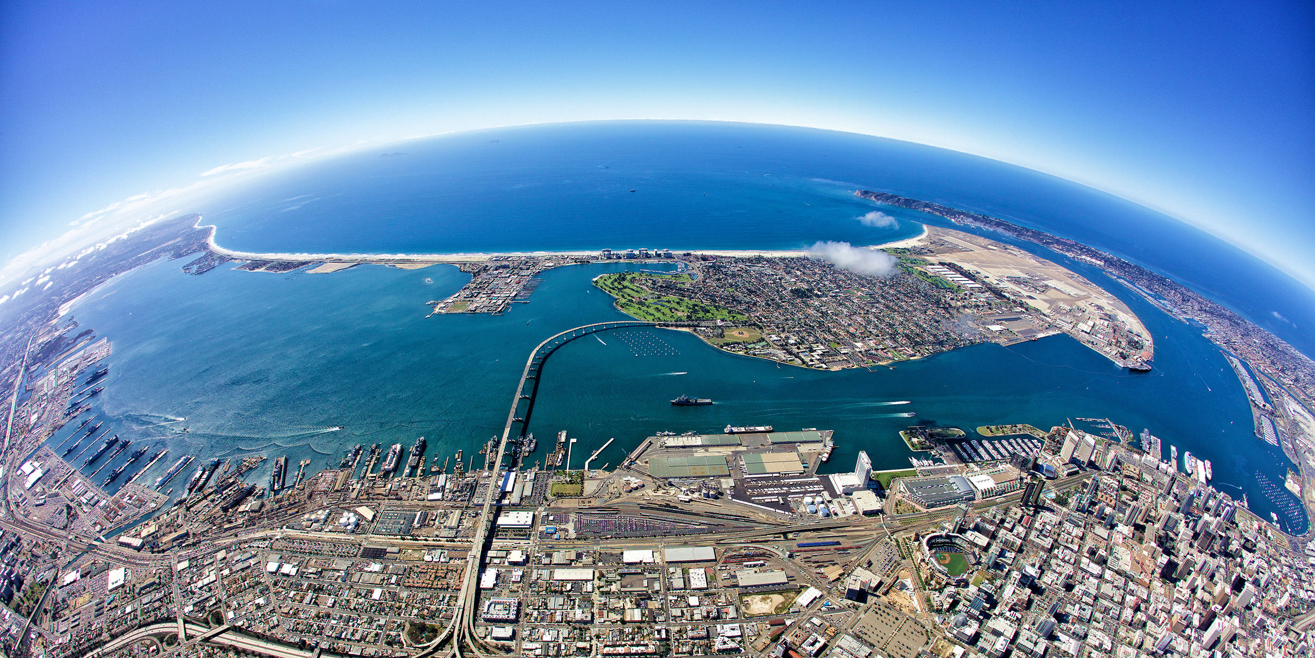
Port of San Diego image
Port of San Diego Master Plan Envisions
A Real Green Belt Around San Diego Bay
By Delle Willett
Boston has an “Emerald Necklace” Park System, San Francisco has its “Golden Gate” Park Loop and, with most of the components already in place, San Diego’s “Green Necklace” vision is just a policy away.
As explained by Ann Moore, a member of the Board of Port Commissioners from Chula Vista, “The Green Necklace is the idea to create a connection along the entire length of San Diego Bay’s 50 measurable-mile shoreline between our various parks and open spaces and look at them as a whole instead of as separate parks throughout the Port.”
The idea of having a Green Necklace around San Diego Bay came during the Port of San Diego’s work on updating its 35-year-old Port Master Plan.
Moore recalls noticing when she joined the board in 2011 that the plan was consistently being amended as each project came through.
Said Moore, a land-use attorney with Norton Moore Adams, “The Port Master Plan is like our constitution for land-use, for everything we do in the port, and to amend it each time a project came through just seemed to me not to be the best way to do planning and just increases the time and costs of these projects.”
To facilitate the process of updating the plan the port brought in Texas-based HKS Urban Design Studio. After months of integrated planning, which started in 2013 when Moore was chair of the Port Commission board, the commissioners identified a vision and a series of master-planning principles that will define the efforts needed for an update of the current Port Master Plan.

The concept of integrated planning is to take into consideration what other adjacent jurisdictions are doing and plan in respect to that. To work with adjacent jurisdictions to achieve symmetry.
“It’s like a jigsaw puzzle where you have to fit all the pieces together, getting this beautiful picture as opposed to keeping each little piece as a separate part,” said Moore.
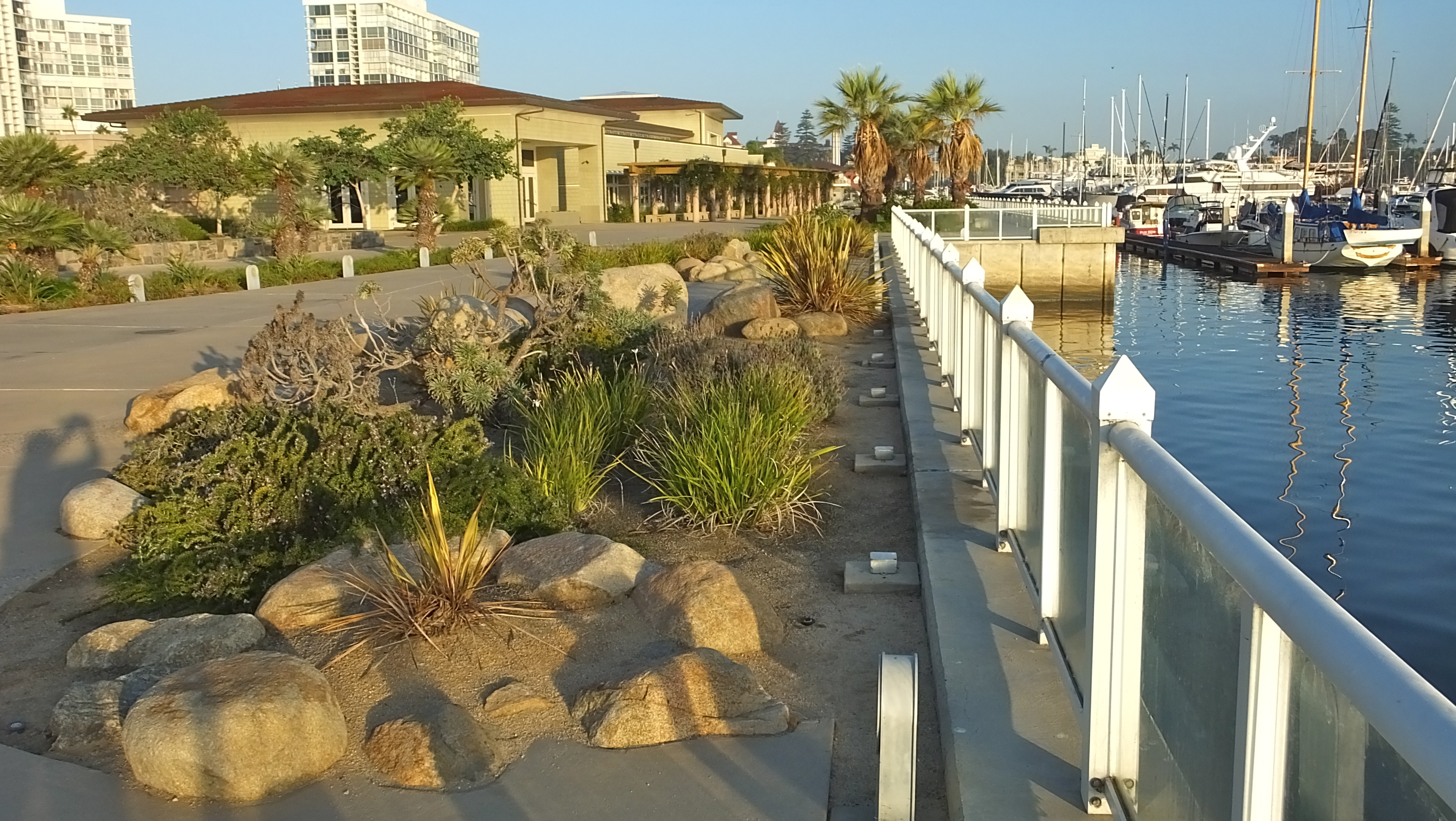
Moore felt one of the principles that was very important to include in the master plan was the idea of having a comprehensive park-system plan that maximized public access to the Bay. At this time there is no continuous path around the Bay and there are few access points to the water.
The vision is to have a continuous network that connects existing and new waterfront parks and other open spaces. Integrate this network with the Bayshore Bikeway, existing waterfront streets and any existing and future ferry routes. Consider planning, programming, maintenance, and enforcement of new parks and water-access provisions when making decisions related to open space.
Currently the Port has 22 parks scattered around about 147 acres, varying from high-use urban park spaces to sensitive naturalized shorelines, from less than an acre to 22 acres.
“And a lot these parks are not functioning to imprint the full majesty of our Bay,” said Moore. “A lot of people don’t even know they are there.”
The current parks cover just over 8 percent of the total land located within the Port’s jurisdiction — well below the amount of public, recreational parkland expected at the best-of-class waterfronts.
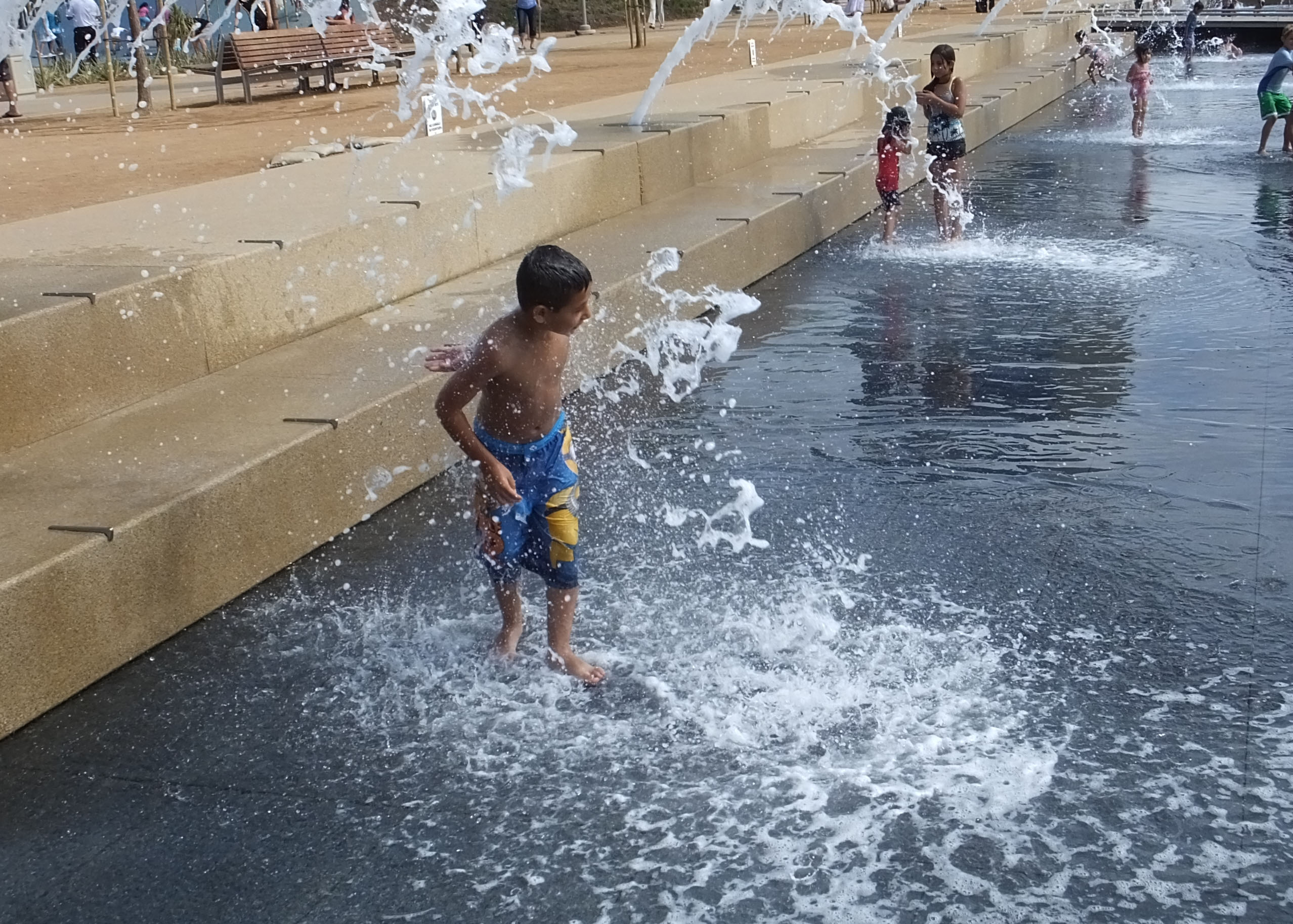
“We need to have more parks that people want to visit and we need to connect them to each other. We need to create places where people want to go and we need a comprehensive park vision to guide us,” said Moore.
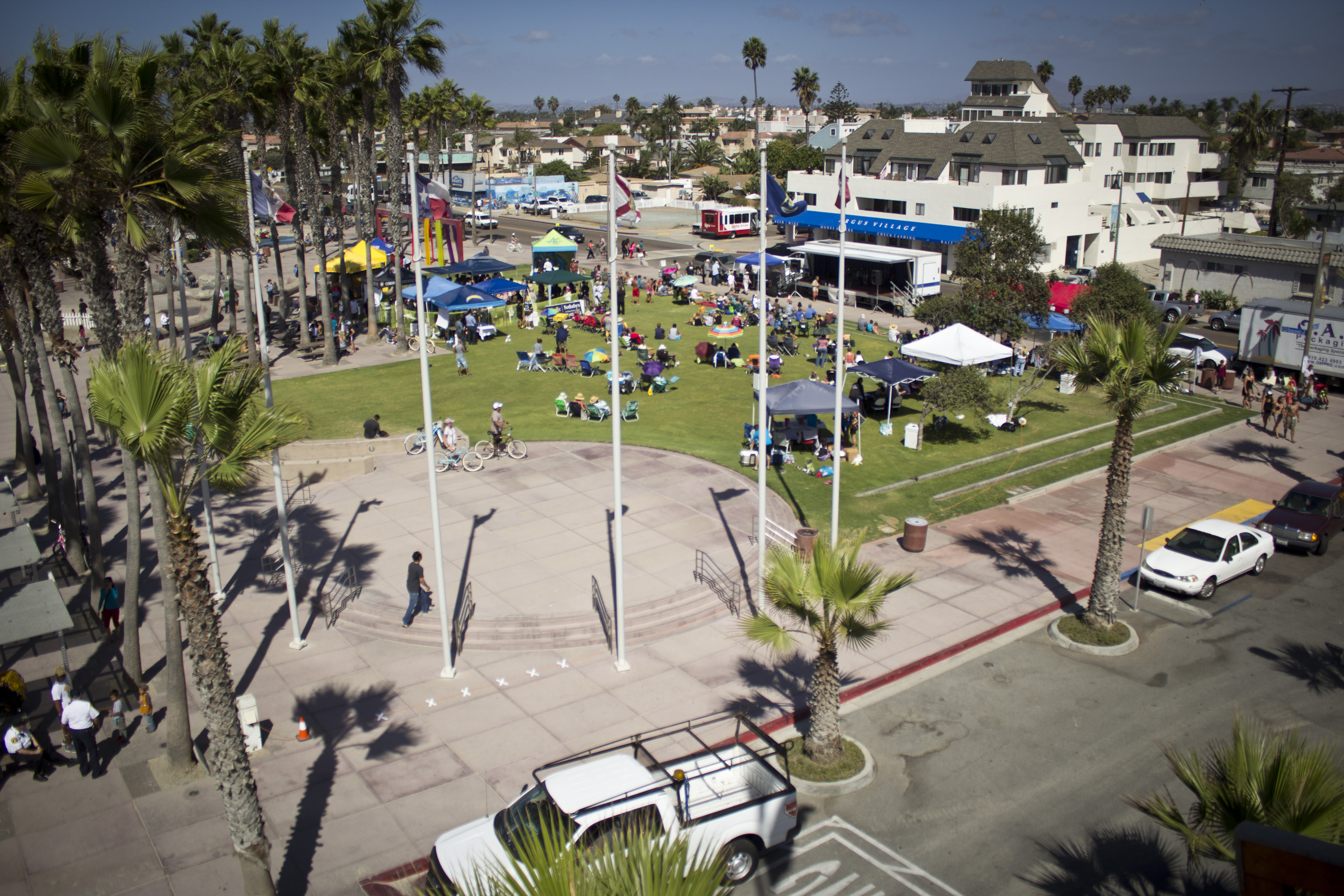
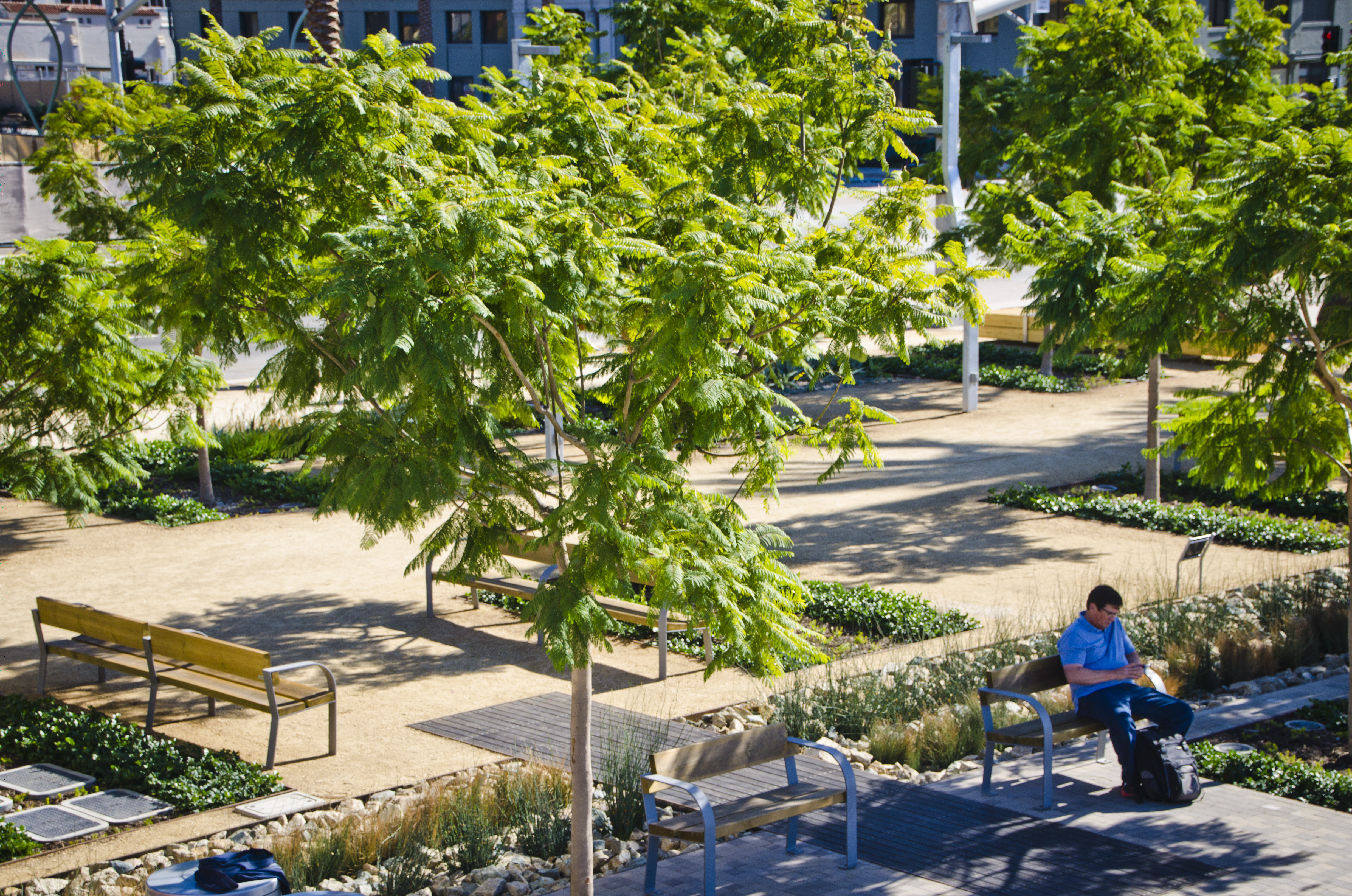
is one of the elements of the ‘green necklace.’
Some existing parks provide a programmed park experience catering to large events, such as Waterfront Park; others provide exposure to natural ecosystems, offer boat launches for direct-water recreational use, or accommodate informal sports games.
According to the HKS Assessment Report, the Bay shoreline defines San Diego and to experience it is to realize a sense of place, yet what could be a powerful, singular experience alongside the Bay becomes diluted and at times, detached from the Bay itself.
Existing conditions along the Bay perimeter often separate or obstruct physical and visual connections between public open spaces, adjacent communities and waterfront land along the Bay, adversely impacting the overall waterfront experience.
Many parks are separated from the Port’s industrial working waterfront through fences, walls and diverted visual cues.
Military presence within the Bay adds an additional barrier to the waterline, often isolating public-use areas and disconnecting possible corridors between open spaces.
Structures within the parks often block rather than enhance views.
Buildings and parking lots often initiate the arrival experience at a park, blocking the most important view to the Bay in doing so.
Most of the parks are parallel to the water and not perpendicular. These parks rarely bring a sense of the waterfront farther upland.
Most of these parks do not tie in directly to key streets, bikeways or paths and do not add to the public’s ability to easily access the water’s edge, unless they drive there.
While Harbor Drive follows the Bay’s contours, there are few entry points to the bay-front as a result of current land uses, expansive parking lots, obstructive infrastructure, physical land challenges and jurisdictional control.
Similarly, bicycle connectivity along the Bay waterfront is lacking in many areas. Many bike connections around the Bay exist only as shared roadways with daunting traffic conditions and unwelcoming edges, resulting from a combination of industrial, military and walled-off residential land uses.
And some of the solutions include:
Creating a “Haul Road” that is designated for the major trucks, separated from Harbor Drive, creating a safer passage on Harbor Drive for regular vehicles, bikes and pedestrians.
Continuing to improve upon the public open-space network through additional land designations, connectivity and accessibility to their spaces that will allow for increased public-art opportunities and further enhance the existing park.
Making sure there are transportation connections and that when they plan other projects they take into consideration where they are.
Working to create parks where people want to go to interact with one another.
Creating connections to key streets and upland amenities that would greatly increase the number of access points to the water.
And continuing to ask, “How can we make our parks express a sense of place?”
Now that the Port Commissioners have completed the integrated-planning process, they are starting the second phase of writing the Port Master Plan, which Moore would like to have board approval by 2018.
Moore feels like San Diego can strengthen its unique identity. “We have this beautiful waterfront and what it really needs is a strong sense of place, a place you want to visit and be a part of. We as trustees of the public tidelands have done our jobs if more people are able to experience the Bay from its wildlife refuge to its active parks. The public should have a sense of pride and ownership in the Bay and there should be a sense of place —that everyone can enjoy. That’s something I want to see through to completion before I leave this position in three years.”
March 30, 2016
San Diego Port Commissioner Ann Moore
Selected for National Planning Advocate Award
San Diego Port Commissioner Ann Moore, a Chula Vistan who has long championed for a more pro-active approach to planning for the Port District’s 6,000 acres of land and water, has been selected to receive the 2016 Planning Advocate Award from the American Planning Association.
The award — officially the National Planning Excellence Award for a Planning Advocate — is presented to just one individual nationwide each year. It recognizes citizens or public officials whose work has advanced the cause of planning — the endeavor of creating and enriching communities.
“Ann has been instrumental in driving consensus among multiple divergent interests and ensuring a sound vision for the Port’s future,” said Port Commissioner Bob Nelson, who nominated Moore for the award. “She is a true champion of planning and has helped colleagues, local businesses, and the community share her fervent commitment and enthusiasm.”
Appointed to the one-year chairmanship of the Board of Port Commissioners in 2013, Moore immediately began campaigning for a better, less reactive approach to planning for the Port’s land and water acreage that spans five cities.
The award citation states that many previous planning efforts were largely developer driven, posing a challenge in balancing multiple priorities for the greater good. In launching the Integrated Planning initiative, Moore focused on ensuring a meaningful civic engagement process.
In August 2014, the Board of Port Commissioners unanimously adopted the Vision Statement and Guiding Principles that Moore helped shepherd. The Port’s new vision and principles — which empower planners to better balance commerce, economic impact, and public space development — will allow for the next phase of the Integrated Planning process to update the Port Master Plan.
“Ann Moore not only initiated Integrated Planning at the Port of San Diego, but she has worked tirelessly to ensure that this project continues its forward momentum,” said Chairman Marshall Merrifield. “Commissioner Moore has provided a great legacy to the Port through this historic planning effort, with an unprecedented level of community engagement.”
“Ann’s work in initiating, leading, and carrying forward this project is a legacy that will help guide the Port of San Diego for the next 50 years,” said Mayor Kevin Faulconer. “San Diego is the better for her bold and dedicated leadership.”
The 2016 APA National Planning Award recipients will be honored at a special luncheon on April 4 during the APA National Planning Conference in Phoenix, Ariz. The award winners will also be featured in the April 2016 issue of Planning magazine.